
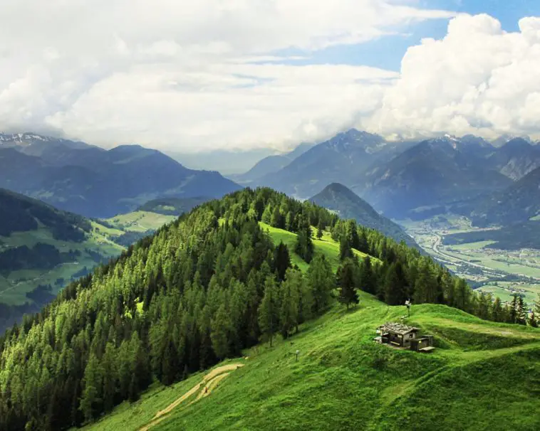
Landforms are natural features that exist on the Earth’s surface and are shaped by various natural processes. These processes include erosion, volcanic activity, tectonic plate movement, and weathering, which have taken millions of years to form these unique features.
The study of landforms is a crucial aspect of geography, as it helps us understand the Earth’s physical characteristics and how they have evolved over time.
The Earth’s surface is composed of different types of landforms, including mountains, hills, plateaus, valleys, and plains, each with its own distinct characteristics. These landforms differ in terms of their elevation, shape, location, and the natural processes that formed them.
Therefore, comprehending the differences between these landforms is essential in understanding the Earth’s geography and the impact of natural processes on its surface. Additionally, landforms can be categorized into two broad categories, high-relief and low-relief landforms, based on their elevation, shape, and formation.
This classification is particularly important in comprehending the Earth’s topography and how it has changed over time.
Types of Landforms
Landforms are natural formations on the Earth’s surface resulting from geological processes. These formations come in various types, each with distinct characteristics, formation methods, and geographical locations. The major landform types include:
Mountains
Mountains are geological formations that tower above the surrounding terrain, displaying steep inclines and rough terrain. They are the result of either tectonic plate shifts or volcanic eruptions. Mountains can be categorized based on their size, shape, and location, with fold mountains, fault-block mountains, and volcanic mountains being some of the most prominent types.
Hills
Hills are topographical features that are shorter in stature than mountains and have a rounded peaks. They are the result of either erosion, deposition, or tectonic shifts. Hills are most frequently situated in regions with gradual inclines and are utilized for agriculture and grazing purposes.
Plateaus
Plateaus, flat-topped landforms that rise above the surrounding terrain are created through tectonic uplift or volcanic action. These elevated areas are commonly found in arid or semi-arid regions and are utilized for agriculture, mining, and transportation purposes.
Valleys
Valleys are geographical formations that lie in a depression between mountains or hills. They are shaped by the erosive forces of rivers or glaciers. Valleys are frequently utilized for settlement and farming purposes.
Canyons
Canyons, characterized by their narrowness, steep sides, and depth, are geological formations caused by erosion. The erosion is usually carried out by rivers or glaciers, and canyons are often found in arid regions. These natural wonders are popular tourist destinations due to their unique and awe-inspiring appearance.
Islands
Islands are land masses that are completely encircled by water. They can be created through volcanic eruptions, tectonic movements, or erosion. The utilization of islands can include tourism, fishing, and agriculture.
Formation of Landforms

Landforms are the physical characteristics that comprise the Earth’s surface, shaped by natural processes that have occurred over millions of years. This section delves into the diverse processes that give rise to landforms.
Tectonic Plate Movement
Tectonic plate movement plays a significant role in shaping the Earth’s surface by creating various landforms. When two plates converge, they can give rise to mountains, hills, and other elevated features, also known as orogeny. On the other hand, when plates diverge, they can lead to the formation of rift valleys and other landforms. When the plates slide past each other, they can create faults and other geological features.
Erosion and Weathering
Erosion and weathering gradually break down landforms through the forces of water, wind, and ice. Over time, water can wear away rock and form canyons and valleys. Softer rock can be eroded by wind, resulting in unique features like arches and hoodoos. Additionally, ice can shape valleys and other landforms.
Volcanic Activity
Volcanic activity has the potential to generate various landforms. As magma ascends to the surface, it can construct volcanoes and other similar features. As magma cools and solidifies, it can produce igneous rock formations. Additionally, volcanic activity may create islands and other landforms.
Glaciation
Glaciation is a geological process that involves the transformation of land by glaciers. Glaciers can create unique landforms by carving out valleys and other features. In addition, they can deposit sediment to create moraines and drumlins. Glaciation can also lead to the formation of lakes and other bodies of water.
Characteristics of Landforms
Height and Slope
Landforms can be differentiated based on their height and slope. Mountains are the tallest type of landform, while hills are shorter and less steep. Plateaus are flat-topped and found at higher elevations than plains, which are generally flat and at a lower elevation. Slopes can range from gentle to steep cliffs.
Shape and Size
The physical attributes of a landform, such as its shape and size, are crucial characteristics. Mountains can appear in various shapes, such as conical, pyramidal, or blocky. Hills, on the other hand, often have a rounded or elongated appearance, while plateaus are flat and extensive. Plains can either be massive, stretching for thousands of miles, or relatively small, like a valley nestled between hills.
Composition
The composition of a landform is determined by the rock or sediment that forms it. Mountains typically consist of igneous or metamorphic rock, while hills and plateaus are usually composed of sedimentary rock. Plains can consist of various materials, such as sand, gravel, and clay.
Location and Climate
How a landform is influenced by its location and climate is significant in shaping its characteristics. Coastal landforms are prone to erosion from the ocean, while those in arid regions are shaped by wind and water scarcity. The vegetation that grows on a landform can also be affected by the climate, which in turn can impact erosion and other geological processes.
Conclusion
Landforms are diverse and unique features that compose the Earth’s surface. These formations result from natural forces such as erosion, tectonic plate movement, volcanic activity, and folding and faulting. The four major types of landforms are mountains, hills, plateaus, and plains, while minor landforms include buttes, canyons, valleys, and basins.
Each type of landform boasts its own distinct characteristics. Mountains, for instance, range in height and steepness, while plateaus remain mostly flat. Plains, on the other hand, are characterized by their rolling hills. The formation of each landform is also unique, with some taking millions of years to develop and others appearing in just a few days.
Landforms are not only visually stunning but also have ecological and economic significance. They provide habitats for diverse plant and animal species and serve as sources of natural resources such as minerals, water, and timber. Therefore, it is important to study and understand landforms to better recognize the beauty of our natural world and develop sustainable ways of utilizing their resources.
By recognizing the unique characteristics and formations of various landforms, we can better appreciate the diversity and complexity of the Earth’s surface. Studying landforms enables us to develop sustainable ways of exploiting their resources while preserving and protecting the environment. In conclusion, landforms are vital components of the Earth’s surface, and understanding their diverse nature and ecological and economic importance is essential for creating a sustainable future.